Science

A thermal based technology as fundament for our data

SEBAL model

The Surface Energy Balance Algorithm for Land (SEBAL) is the core model of IrriWatch. SEBAL is based on the turbulent transport of momentum, sensible heat and latent heat fluxes between land and atmosphere using the Monin Obukhov theorem. It is distributing the net available energy between hot (zero latent heat flux) and cold pixels (zero sensible heat flux) by an automated internal calibration process using endmembers based on ranges of land surface temperature. For 30 years, Professor Bastiaanssen and his M.Sc. and Ph.D. students have done field research to ground-truth the evapotranspiration, soil moisture and crop production estimates from SEBAL. This includes validation in cereals, root and tuber crops, tropical fruit trees, vegetables, legumes, fibre crops and fodders. There are hundreds of scientific articles publicly accessible.

We utilize satellite data

The measurements of leaf temperature, solar radiation, crop leaf size and photosynthesis are all based on earth observation satellites. Satellites measure the crop routinely every day and for all fields and countries in an identical manner. The raw satellite data is made available by the space agencies. Using SEBAL, the actual evapotranspiration (ET), soil moisture and carbon flux (C) is processed from this raw data. Crops with an increased leaf temperatures have insufficient access to water, or are limited by something else.

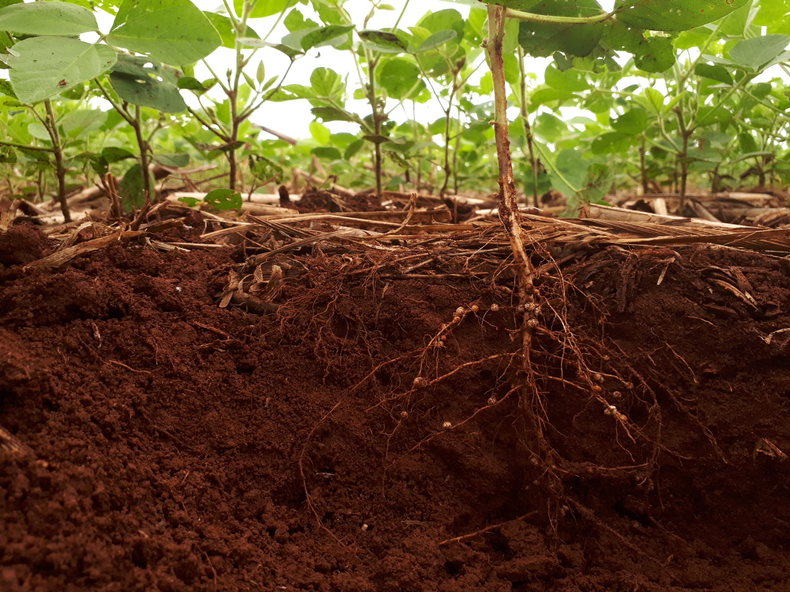
The rate of transpiration is similar to sap-flow which reflects the uptake of water by roots. Hence, we can determine essential root zone processes and determine fundamental underground physical processes that are not visible from above. A background lecture on the crop and soil physics can be found on the IrriWatch YouTube channel.

We look into the root zone

Irrigation scheduling is more than assessing an above-ground crop coefficient Kc. For this reason, we determine soil water potential and soil moisture integrated across the root zone for deciding on the timing of irrigation, the minimum amount to replenish depleted water and the maximum amount for minimizing percolation losses. Solutions based on microwave satellites estimate at best the skin soil moisture of the 5 cm and are thus avoided in the IrriWatch technology. We look deeper.

The core model in 5 bullets

  • Satellites measure leaf temperature, solar radiation, crop leaf size and photosynthesis
  • Leaf temperature at a certain vegetation cover and radiation level reflects the actual sap-flow through the crop.
  • The sap-flow responds to leaf water and soil water potential. So we can look into the soil and determine physical processes of the root zone
  • The critical soil moisture expresses the threshold value for reduced sap-flow and diminished crop production.
  • Information on fluctuations of soil moisture in relation to critical soil moisture is a sound basis for decisions on irrigation actions.

WE HAVE REFINED OUR TECHNOLOGY THROUGH 30 YEARS OF FIELD TESTING

The most accurate method available

SEBAL is generally found quite satisfactory and largely accurate in estimating evapotranspiration. It is inspected, verified and validated by various independent and international universities and research institutes. More recently, the 4th generation of SEBAL has been verified by our clients. We published an IrriWatch Validation Book for field tests conducted during 2020. Eight different countries have been involved as well as different crop types have been tested (corn, rice, sugar beet, potatoes, onions, grapes, almonds, walnuts). The validation is done for meteorological parameters, evapotranspiration, soil moisture and crop yield. In most cases the bias factor varies from 0.97 to 1.03 and the correlation coefficient between R2 = 0.8 and 0.99. The field measurements have also their own challenges to automatically measure bio-physical processes. The deviations found are often within the error margins of the field measurements.

International universities have always done independent investigations towards the accuracy of SEBAL. Two recent excellent papers are from Dr. Hadi Jafaar and his co-workers from the American University of Beirut (Jaafar, H.H. and Ahmad, F.A. 2019. “Time series trends of Landsat-based ET using automated calibration in METRIC and SEBAL: The Bekaa Valley, Lebanon”, Remote Sensing of Environment) and Dr. Poolad Karimi from IHE – Delft (Spatial evapotranspiration, rainfall, and land use data in water accounting – Part 1: Review of the accuracy of the remote sensing data, Hydrology and Earth System Sciences). Much more international literature on the accuracy of SEBAL is accessible in the public domain.

Download The 2020 Validation Book